Réservoir-Dozois, Quebec
Réservoir-Dozois is an unorganized territory in the Abitibi-Témiscamingue region of Quebec, Canada. It is the largest of five unorganized territories in the La Vallée-de-l'Or Regional County Municipality and entirely part of the La Vérendrye Wildlife Reserve.
Réservoir-Dozois | |
|---|---|
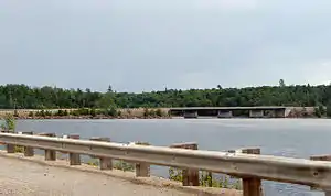 Dozois Reservoir and Quebec Route 117 | |
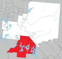 Location within La Vallée-de-l'Or RCM | |
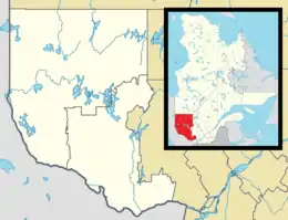  Réservoir-Dozois Location in western Quebec | |
| Coordinates: 47°30′N 77°05′W[1] | |
| Country | .svg.png.webp) Canada Canada |
| Province |  Quebec Quebec |
| Region | Abitibi-Témiscamingue |
| RCM | La Vallée-de-l'Or |
| Constituted | January 1, 1986 |
| Government | |
| • Federal riding | Abitibi—Baie-James— Nunavik—Eeyou |
| • Prov. riding | Abitibi-Est |
| Area | |
| • Total | 4,665.70 km2 (1,801.44 sq mi) |
| • Land | 3,837.40 km2 (1,481.63 sq mi) |
| Population (2011)[3] | |
| • Total | 0 |
| • Density | 0.0/km2 (0/sq mi) |
| • Pop 2006-2011 |  0.0% 0.0% |
| • Dwellings | 3 |
| Time zone | UTC−5 (EST) |
| • Summer (DST) | UTC−4 (EDT) |
| Highways |   Route 117 (TCH) Route 117 (TCH) |
It is named after the Dozois Reservoir, a large reservoir which formed after the construction of the Bourque Dam on the Ottawa River in 1949.[4]
Demographics
Population:[5]
- Population in 1991: 115
- Population in 1996: 0
- Population in 2011: 0
- Population in 2001: 0
- Population in 2006: 0
References
- Reference number 149666 of the Commission de toponymie du Québec (in French)
- Geographic code 89910 in the official Répertoire des municipalités (in French)
- "(Code 2489910) Census Profile". 2011 census. Statistics Canada. 2012.
- "Réservoir Dozois" (in French). Commission de toponymie du Québec. Retrieved 2008-11-13.
- Statistics Canada: 1996, 2001, 2006, 2011 census
External links
 Media related to Réservoir-Dozois at Wikimedia Commons
Places adjacent to Réservoir-Dozois, Quebec | |
|---|---|


| Cities | |
|---|---|
| Municipalities | |
| Parishes | |
| Unorganized territories | |
| |
This article is issued from Wikipedia. The text is licensed under Creative Commons - Attribution - Sharealike. Additional terms may apply for the media files.