Niedertaufkirchen
Niedertaufkirchen is a municipality in the district of Mühldorf in Bavaria in Germany.
Niedertaufkirchen | |
|---|---|
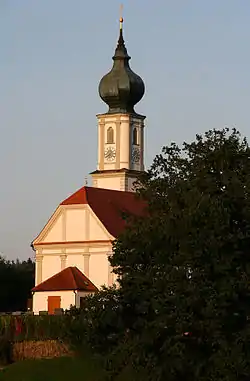 Saint Martin Church | |
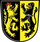
 Coat of arms | |
Location of Niedertaufkirchen within Mühldorf am Inn district 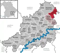 | |
  Niedertaufkirchen  Niedertaufkirchen | |
| Coordinates: 48°20′N 12°33′E | |
| Country | Germany |
| State | Bavaria |
| Admin. region | Oberbayern |
| District | Mühldorf am Inn |
| Municipal assoc. | Rohrbach |
| Government | |
| • Mayor | Sebastian Winkler party = FW |
| Area | |
| • Total | 26.69 km2 (10.31 sq mi) |
| Elevation | 442 m (1,450 ft) |
| Population (2019-12-31)[1] | |
| • Total | 1,419 |
| • Density | 53/km2 (140/sq mi) |
| Time zone | UTC+01:00 (CET) |
| • Summer (DST) | UTC+02:00 (CEST) |
| Postal codes | 84494 |
| Dialling codes | 08639 |
| Vehicle registration | MÜ |
| Website | www.Niedertaufkirchen.de |
References
- "Tabellenblatt "Daten 2", Statistischer Bericht A1200C 202041 Einwohnerzahlen der Gemeinden, Kreise und Regierungsbezirke". Bayerisches Landesamt für Statistik und Datenverarbeitung (in German). July 2020.

This article is issued from Wikipedia. The text is licensed under Creative Commons - Attribution - Sharealike. Additional terms may apply for the media files.