McKinley Heights, St. Louis
The McKinley Heights Neighborhood is a historic conservation district located in the near South Side of the City of St. Louis. It was rated as a Top 10 Neighborhood for young adults in the St. Louis metropolitan area. The neighborhood is bounded by I-44 to the north, Jefferson Avenue to the west, and I-55 and Gravois Boulevard to the east and south. There are restaurants and entertainment in the adjacent Soulard and Lafayette Square neighborhoods. Three bus routes provide a commute downtown or throughout the City. There are three churches and several neighborhood businesses. There is also 1 6th-12th Grade High School, McKinley Classical Leadership Academy
McKinley Heights | |
|---|---|
.jpg.webp) McKinley Heights, April 2017 | |
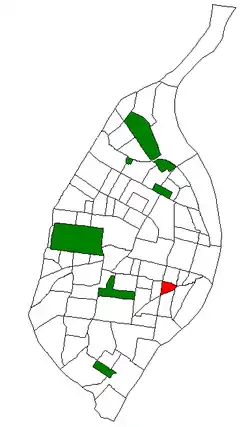 Location (red) of McKinley Heights within St. Louis | |
| Country | United States |
| State | Missouri |
| City | St. Louis |
| Wards | 7 |
| Government | |
| • Aldermen | Jack Coatar |
| Area | |
| • Total | 0.22 sq mi (0.6 km2) |
| Population (2010)[1] | |
| • Total | 1,497 |
| • Density | 6,800/sq mi (2,600/km2) |
| ZIP code(s) | Part of 63104 |
| Area code(s) | 314 |
| Website | stlouis-mo.gov |
Demographics
In 2010 McKinley Height's racial makeup was 48.3% White, 46.0% Black, 0.2% Native American, 0.7% Asian, 4.1% Two or More Races, and 0.7% Some Other Race. 2.7% of the population was of Hispanic or Latino origin.[2]
References
- Census Summary By Neighborhoods Archived 2009-09-02 at the Wayback Machine
- "Archived copy". Archived from the original on 2012-05-16. Retrieved 2012-08-16.CS1 maint: archived copy as title (link)