Lincoln Township, Jackson County, Kansas
Lincoln Township is a township in Jackson County, Kansas, USA. As of the 2000 census, its population was 1,046. The township is located entirely within the Prairie Band Potawatomi Indian Reservation.
Lincoln Township | |
|---|---|
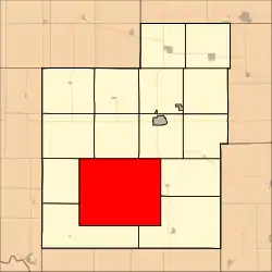 Location in Jackson County | |
| Coordinates: 39°20′25″N 95°51′31″W | |
| Country | United States |
| State | Kansas |
| County | Jackson |
| Area | |
| • Total | 98.35 sq mi (254.73 km2) |
| • Land | 98.31 sq mi (254.62 km2) |
| • Water | 0.04 sq mi (0.12 km2) 0.05% |
| Elevation | 1,089 ft (332 m) |
| Population (2000) | |
| • Total | 1,046 |
| • Density | 10.6/sq mi (4.1/km2) |
| GNIS feature ID | 0478183 |
Geography
Lincoln Township covers an area of 98.35 square miles (254.73 square kilometers); of this, 0.04 square miles (0.12 square kilometers) or 0.05 percent is water. The streams of Big Elm Creek, Crow Creek, Little Elm Creek and South Branch Soldier Creek run through this township.
Adjacent townships
- Banner Township (north)
- Franklin Township (northeast)
- Cedar Township (east)
- Douglas Township (southeast)
- Washington Township (southwest)
- Adrian Township (west)
- Grant Township (northwest)
Cemeteries
The township contains three cemeteries: Danceground, Mitchell and Shipsee.
Major highways
References
External links
Municipalities and communities of Jackson County, Kansas, United States | ||
|---|---|---|
| Cities | 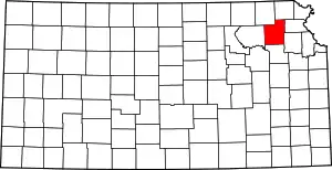 Map of Kansas highlighting Jackson County | |
| Unincorporated communities | ||
| Indian reservations | ||
| Townships | ||
| Footnotes | ‡This populated place also has portions in an adjacent county or counties | |
| ||
This article is issued from Wikipedia. The text is licensed under Creative Commons - Attribution - Sharealike. Additional terms may apply for the media files.