Interstate 55 in Mississippi
Interstate 55 (I-55) is a major north–south Interstate Highway that serves the middle of the United States. It runs 963.5 miles (1,550.6 km) from Interstate 10 in Laplace, Louisiana - about 25 miles (40 km) west of New Orleans to U.S. 41 in Chicago, Illinois. In Mississippi, it runs for about 290.41 miles (467.37 km), entering the state at the Louisiana state line near Osyka and leaving at the Tennessee state line near Southaven, just south of Memphis.
| ||||
|---|---|---|---|---|
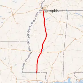
I-55 highlighted in red | ||||
| Route information | ||||
| Maintained by MDOT | ||||
| Length | 290.41 mi[1] (467.37 km) | |||
| Existed | 1955 (proposed in 1939)–present | |||
| Major junctions | ||||
| South end |  I-55 at the Louisiana state line near Osyka I-55 at the Louisiana state line near Osyka | |||
 US 98 near McComb US 98 near McComb US 84 in Brookhaven US 84 in Brookhaven  I-20 / US 49 in Jackson and Richland I-20 / US 49 in Jackson and Richland MS 25 in Jackson MS 25 in Jackson I-220 in Ridgeland I-220 in Ridgeland US 82 in Winona US 82 in Winona  I-69 / I-269 in Hernando I-69 / I-269 in Hernando | ||||
| North end | I-55 / I-69 at the Tennessee state line near Southaven | |||
| Location | ||||
| Counties | Pike, Lincoln, Copiah, Hinds, Rankin, Madison, Yazoo, Holmes, Carroll, Montgomery, Grenada, Yalobusha, Panola, Tate, DeSoto | |||
| Highway system | ||||
| ||||


Route description
The highway parallels US 51 during its trek roughly through the center of Magnolia State. North of Jackson, the Interstate runs east of the bluffs of the Mississippi Delta.
Near Summit and McComb, the interstate is concurrent with US 98 for five miles as it passes through the western side of the cities. I-55 then intersects US 84 near Brookhaven, and becomes concurrent with US 51 near Crystal Springs. In Jackson, the highway is concurrent with I-20 for three exits, and US 51 leaves the concurrency after I-55's concurrency with I-20 begins. I-55 continues north on the eastern side of Jackson, and meets the northern terminus of I-220 near Ridgeland. The highway then parallels US 51 until the U.S. route crosses over to the western side of the interstate in Grenada. I-55 intersects US 278 at Batesville, and it becomes concurrent with I-69 north of Hernando. The highway crosses the state line north of Southaven into Tennessee.
History
Exit list
| County | Location | mi | km | Exit | Destinations | Notes |
|---|---|---|---|---|---|---|
| Pike | | 0.00 | 0.00 | I-55 south – New Orleans | Continuation into Louisiana | |
| | 0.79 | 1.27 | 1 |  MS 584 – Osyka, Gillsburg MS 584 – Osyka, Gillsburg | ||
| | 4.49 | 7.23 | 4 | Chatawa | ||
| | 7.79 | 12.54 | 8 |  MS 568 – Gillsburg, Magnolia MS 568 – Gillsburg, Magnolia | ||
| | 10.24 | 16.48 | 10 |  MS 48 – Magnolia MS 48 – Magnolia | ||
| | 13.29 | 21.39 | 13 | Fernwood, Industrial Park | ||
| McComb | 15.44 | 24.85 | 15 |  US 98 east / MS 24 west – Tylertown, Liberty, South McComb US 98 east / MS 24 west – Tylertown, Liberty, South McComb | South end of US 98 overlap; Formerly signed as exits 15A (US 98) and 15B (MS 24) | |
| 17.30 | 27.84 | 17 | Delaware Avenue – Downtown McComb | |||
| 18.13 | 29.18 | 18 |  MS 570 (Veterans Boulevard) – North McComb MS 570 (Veterans Boulevard) – North McComb | |||
| Summit | 20.13 | 32.40 | 20 | US 98 west – Natchez, Summit | North end of US 98 overlap; Signed as exits 20A (Summit) and 20B (US 98) | |
| Lincoln | | 24.31 | 39.12 | 24 | Lake Dixie Springs, Johnstons Station | |
| | 29.52 | 47.51 | 30 | Bogue Chitto, Norfield | ||
| Bogue Chitto River | Bridge | |||||
| | 37.66 | 60.61 | 38 | US 84 – South Brookhaven, Natchez | ||
| Brookhaven | 40.22 | 64.73 | 40 | Brookway Boulevard (MS 558 east) To MS 550 – Downtown Brookhaven To MS 550 – Downtown Brookhaven | ||
| | 42.14 | 67.82 | 42 | North Brookhaven | ||
| | 48.25 | 77.65 | 48 | Mount Zion Road | ||
| Copiah | | 51.27 | 82.51 | 51 | Wesson | |
| | 56.27 | 90.56 | 56 | Martinsville | ||
| | 58.67 | 94.42 | 59 | South Hazelhurst | ||
| | 61.00 | 98.17 | 61 |  MS 28 – Hazelhurst, Fayette MS 28 – Hazelhurst, Fayette | ||
| | 64.67 | 104.08 | 65 | Gallman | ||
| | 67.95 | 109.35 | 68 | South Crystal Springs (MS 844) | ||
| | 71.26 | 114.68 | 72 |   US 51 south / MS 27 – North Crystal Springs, Utica US 51 south / MS 27 – North Crystal Springs, Utica | South end of US 51 overlap | |
| Hinds | Terry | 78.23 | 125.90 | 78 | Terry | |
| | 80.58 | 129.68 | 81 | Wynndale Road | ||
| | 84.53 | 136.04 | 85 | Byram | ||
| Jackson | 87.71 | 141.16 | 88 | Elton Road | ||
| 89.29 | 143.70 | 90A | Savanna Street | |||
| 90.02 | 144.87 | 90B | Daniel Lake Boulevard | Southbound exit and northbound entrance | ||
| 91.14 | 146.68 | 92A | McDowell Road | |||
| 91.57 | 147.37 | 92C | I-20 west / US 49 north / Terry Road – Vicksburg, Monroe | South end of I-20 / US 49 overlap; Northbound exit and southbound entrance; I-20 exit 46 eastbound | ||
| Bridge over the Pearl River | ||||||
| 92.52 | 148.90 | 45A | Gallatin Street | Northbound exit via exits 45 and 92B | ||
| 92.90 | 149.51 | 45B | US 51 north (State Street) | North end of US 51 overlap; Signed as exits 45 and 92B northbound | ||
| Rankin | Flowood | 93.56 | 150.57 | 94 | I-20 east / US 49 south – Meridian | North end of I-20 / US 49 overlap; Southbound exit and northbound entrance; I-20 exit 44 westbound |
| Pearl River | Bridge | |||||
| Hinds | Jackson | 95.21 | 153.23 | 96A | Pearl Street-Telcom Center, Convention Complex | |
| 95.52 | 153.72 | 96B | High Street – State Capitol | |||
| 96.05 | 154.58 | 96C | Fortification Street | |||
| 97.28 | 156.56 | 98A | Woodrow Wilson Avenue | |||
| 97.85 | 157.47 | 98B | MS 25 north (Lakeland Drive) – Carthage | Formerly signed as exits 98B (east) and 98C (west) | ||
| 98.98 | 159.29 | 99 | Meadowbrook Road | Southbound exit via exit 100 | ||
| 99.51 | 160.15 | 100 | Northside Drive | |||
| 101.24 | 162.93 | 102A | Briarwood Drive | Northbound exit and southbound entrance | ||
| 101.59 | 163.49 | 102B | Beasley Road / Adkins Boulevard | Signed as exit 102 southbound | ||
| 102.58 | 165.09 | 103 | County Line Road - Ridgeland | |||
| Madison | Ridgeland | 103.51 | 166.58 | 104 | I-220 south – West Jackson | Northern terminus of I-220 |
| 104.62 | 168.37 | 105A |  Natchez Trace Parkway Natchez Trace Parkway | |||
| 104.79 | 168.64 | 105 B-C | Jackson Avenue / Old Agency Road - Ridgeland | Signed as exits 105B and 105C northbound | ||
| | 106.68 | 171.68 | 107 | Colony Park Boulevard / Madison Avenue | ||
| | 107.66 | 173.26 | 108 |  MS 463 – Madison MS 463 – Madison | ||
| | 111.59 | 179.59 | 112 | Gluckstadt | ||
| | 113.27 | 182.29 | 114 | Sowell Road | Signed as 114A (east) and 114B (west) southbound | |
| | 116.82 | 188.00 | 118 | Nissan Parkway (MS 16 east) | Signed as exits 118A (east) and 118B (west); southern end of MS 16 overlap | |
| Canton | 118.15 | 190.14 | 119 |  MS 22 – Canton, Flora MS 22 – Canton, Flora | ||
| | 123.51 | 198.77 | 124 |  MS 16 west – North Canton, Yazoo City MS 16 west – North Canton, Yazoo City | Northern end of MS 16 overlap | |
| Big Black River | Bridge | |||||
| Yazoo | | 132.56 | 213.33 | 133 | Vaughan | |
| | 138.14 | 222.31 | 139 |  MS 432 – Pickens, Yazoo City, Benton MS 432 – Pickens, Yazoo City, Benton | ||
| Holmes | | 143.17 | 230.41 | 144 |  MS 17 – Pickens, Lexington MS 17 – Pickens, Lexington | |
| | 145.74 | 234.55 | 146 |  MS 14 – Goodman, Ebenezer MS 14 – Goodman, Ebenezer | ||
| | 149.37 | 240.39 | 150 | Holmes County State Park | ||
| | 155.41 | 250.11 | 156 |  MS 12 – Durant, Lexington MS 12 – Durant, Lexington | ||
| | 163.85 | 263.69 | 164 | West | ||
| Carroll | Vaiden | 173.64 | 279.45 | 174 |   MS 35 / MS 430 – Vaiden, Carrollton MS 35 / MS 430 – Vaiden, Carrollton | |
| Montgomery | Winona | 184.07 | 296.23 | 185 | US 82 – Winona, Greenwood | |
| Carroll | | 194.56 | 313.11 | 195 |  MS 404 – Duck Hill MS 404 – Duck Hill | |
| Grenada | | 198.10 | 318.81 | 199 | Nat G. Troutt Road – South Grenada | |
| Grenada | 205.45 | 330.64 | 206 |   MS 7 south / MS 8 – Grenada, Greenwood MS 7 south / MS 8 – Grenada, Greenwood | South end of MS 7 overlap | |
| 207.37 | 333.73 | 208 | Paper Mill Road – North Grenada | |||
| | 210.77 | 339.20 | 211 |  MS 7 north / MS 333 – Coffeeville MS 7 north / MS 333 – Coffeeville | North end of MS 7 overlap | |
| Yalobusha | | 219.43 | 353.14 | 220 |  MS 330 (Tillatoba Road) – Coffeeville MS 330 (Tillatoba Road) – Coffeeville | |
| | 225.98 | 363.68 | 227 |  MS 32 – Oakland, Water Valley MS 32 – Oakland, Water Valley | ||
| | 231.72 | 372.92 | 233 | Enid | ||
| Panola | | 236.48 | 380.58 | 237 | Pope, Courtland | |
| Batesville | 242.30 | 389.94 | 243 |   US 278 / MS 6 – Oxford, Batesville US 278 / MS 6 – Oxford, Batesville | formerly signed as exits 243A-B | |
| 245.15 | 394.53 | 246 |  MS 35 / MS 315 – North Batesville MS 35 / MS 315 – North Batesville | |||
| Sardis | 251.18 | 404.24 | 252 | MS 315 – Sardis, Sardis Dam | ||
| | 256.43 | 412.68 | 257 |  MS 310 – Como MS 310 – Como | ||
| Tate | Senatobia | 262.00 | 421.65 | 263 |  MS 740 – South Senatobia MS 740 – South Senatobia | |
| 264.19 | 425.17 | 265 |  MS 4 – Holly Springs, Senatobia MS 4 – Holly Springs, Senatobia | |||
| Coldwater | 269.86 | 434.30 | 271 |  MS 306 (MS 304 Scenic) – Independence, Coldwater MS 306 (MS 304 Scenic) – Independence, Coldwater | Counterclockwise terminus of MS 304 Scenic | |
| DeSoto | Hernando | 278.50 | 448.20 | 280 |    MS 304 Scenic west (Commerce Street) – Hernando, Arkabutla Lake MS 304 Scenic west (Commerce Street) – Hernando, Arkabutla Lake | Clockwise terminus of MS 304 Scenic; former MS 304 |
| 281.24 | 452.61 | 283 |  I-69 south / MS 304 west / I-269 east – Tunica, Casinos I-69 south / MS 304 west / I-269 east – Tunica, Casinos | South end of I-69 overlap; I-269 western terminus | ||
| 282.74 | 455.03 | 284 | Nesbit Road / Pleasant Hill Road - North Hernando | |||
| Southaven | 286.22 | 460.63 | 287 | Church Road –Southaven, Horn Lake | ||
| 288.26 | 463.91 | 289 |  MS 302 (Goodman Road) – Southaven, Horn Lake, Olive Branch MS 302 (Goodman Road) – Southaven, Horn Lake, Olive Branch | |||
| Mississippi–Tennessee line | 290.29– 290.51 | 467.18– 467.53 | 291 | Southaven | ||
| I-55 / I-69 north – Memphis | Continuation into Tennessee | |||||
1.000 mi = 1.609 km; 1.000 km = 0.621 mi
| ||||||
References
 |
Wikimedia Commons has media related to Interstate 55 in Mississippi. |
- "Route Log and Finder List - Interstate System: Table 1". FHWA. Retrieved 2007-10-05.
| Interstate 55 | ||
|---|---|---|
| Previous state: Louisiana |
Mississippi | Next state: Tennessee |