Hetan, Xinhuang
Hetan (Chinese: 禾滩镇) is a rural town in Xinhuang Dong Autonomous County, Hunan, China. As of the 2015 census it had a population of 17,316 and an area of 160.99-square-kilometre (62.16 sq mi).[1] It borders Huangzhou Town in the north, Butouxiang Miao Ethnic Township in the east, Zhongzhai Town in the southeast, and Fuluo Town in the west and southwest.
Hetan Town | |
|---|---|
| Chinese transcription(s) | |
| • Simplified | 禾滩镇 |
| • Traditional | 和灘鎮 |
| • Pinyin | Hétān Zhèn |
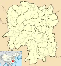  Hetan Town Location in Hunan | |
| Coordinates: 27°17′08″N 109°14′19″E | |
| Country |  China China |
| Province | Hunan |
| Prefecture | Huaihua |
| Autonomous county | Xinhuang Dong Autonomous County |
| Area | |
| • Total | 160.99 km2 (62.16 sq mi) |
| Population (2015) | 17,316 |
| Time zone | UTC+8 (China Standard) |
| Postal code | 410636 |
| Area code(s) | 0745 |
History
In October 2015, some places of former Dongping Township (Chinese: 洞坪乡) and former Lishu Township (Chinese: 李树乡) merged into Hetan Township to form Hetan Town.[1]
Geography
The highest point in the town is Mount Gunmapo (Chinese: 滚马坡) which stands 916.7 metres (3,008 ft) above sea level.[2]
The Fuluo River (Chinese: 扶罗河) winds through the town.[2]
Transportation
The Provincial Highway S232 passes across the town north to south.[3]
References
- 重磅!新晃调整乡镇区划 23个乡镇合为11个!. rednet.cn (in Chinese). 30 October 2015.
- Huang Xuehong, ed. (2007). "Administrative division map of Xinhuang Dong Autonomous County" 《新晃侗族自治县行政区划图》. 《新晃侗族自治县概况》 [General Situation of Xinhuang Dong Autonomous County] (in Chinese). Beijing: Nationalities Publishing House. p. 1. ISBN 978-7-105-08619-1.
- Zhang Hong, ed. (2018). "Xinhuang Dong Autonomous County" 《新晃侗族自治县》. 《中国分省系列地图册:湖南》 [Maps of Provinces in China: Hunan] (in Chinese). Xicheng District, Beijing: SinoMaps Press. p. 164. ISBN 978-7-5031-8949-4.