Thompson River (Montana)
The Thompson River is a tributary of the Clark Fork in the U.S. state of Montana. It is part of the Columbia River basin, as Clark Fork is a tributary of the Pend Oreille River, which is a tributary of the Columbia River.
| Thompson River | |
|---|---|
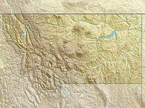  Location of the mouth of the Thompson River in Montana | |
| Location | |
| Country | United States |
| State | Montana |
| County | Sanders County |
| Physical characteristics | |
| Source | |
| • location | Rocky Mountains, Montana |
| • coordinates | 48°0′52″N 115°11′27″W[1] |
| • elevation | 3,337 ft (1,017 m)[2] |
| Mouth | Clark Fork |
• location | Thompson Falls, Montana |
• coordinates | 47°34′37″N 115°14′23″W[1] |
• elevation | 2,405 ft (733 m)[3] |
| Discharge | |
| • location | Thompson Falls, Montana |
| • average | 439 cuft/s [4] |
| • minimum | 80 cuft/s |
| • maximum | 1,785 cuft/s |
| Basin features | |
| Tributaries | |
| • left | [[Little Thompson River (Montana)|]] |
The Thompson River is named in honor of David Thompson.
Course
The Thompson River originates in Upper Thompson Lake and flows generally south to join Clark Fork near the town of Thompson Falls.
See also
- List of rivers of Montana
- Tributaries of the Columbia River
References
- U.S. Geological Survey Geographic Names Information System: Thompson River
- Source elevation derived from Google Earth search using GNIS source coordinates.
- Mouth elevation derived from Google Earth search using GNIS mouth coordinates.
- https://waterdata.usgs.gov/mt/nwis/uv/?site_no=12389500&PARAmeter_cd=00065,00060,00010
Authority control  |
|
|---|
This article is issued from Wikipedia. The text is licensed under Creative Commons - Attribution - Sharealike. Additional terms may apply for the media files.