Swans Branch (Brown Creek tributary)
Swans Branch is a tributary of Brown Creek in Anson County, North Carolina that rises in the town of Peachland, North Carolinaand then flows east to meet Brown Creek south of Polkton, North Carolina. The watershed is about 57% forested, 35% agricultural and the rest is of other land uses.[4]
| Swans Branch Tributary to Brown Creek | |
|---|---|
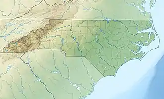  Location of Swans Branch mouth | |
| Location | |
| Country | United States |
| State | North Carolina |
| County | Anson |
| City | Peachland |
| Physical characteristics | |
| Source | divide between Swans Branch and Lanes Creek |
| • location | Peachland, North Carolina |
| • coordinates | 34°59′21″N 080°15′48″W[1] |
| • elevation | 430 ft (130 m)[2] |
| Mouth | Brown Creek |
• location | about 1 mile south of Polkton, North Carolina |
• coordinates | 34°59′28″N 080°12′21″W[1] |
• elevation | 249 ft (76 m)[1] |
| Length | 4.01 mi (6.45 km)[3] |
| Basin size | 4.85 square miles (12.6 km2)[4] |
| Discharge | |
| • location | Brown Creek |
| • average | 5.59 cu ft/s (0.158 m3/s) at mouth with Brown Creek[4] |
| Basin features | |
| Progression | east |
| River system | Pee Dee River |
| Tributaries | |
| • left | unnamed tributaries |
| • right | unnamed tributaries |
| Bridges | US 74, E Passaic Street (twice), US 74, Horne Town Road, Poplar Hill Church Road |
See also
References
- "GNIS Detail - Swans Branch". geonames.usgs.gov. US Geological Survey. Retrieved 12 September 2019.
- "Brown Creek Topo Map, Anson County NC (Ansonville Area)". TopoZone. Locality, LLC. Retrieved 9 September 2019.
- "ArcGIS Web Application". epa.maps.arcgis.com. US EPA. Retrieved 12 September 2019.
- "Swans Branch Watershed Report". Waters Geoviewer. US EPA. Retrieved 12 September 2019.
This article is issued from Wikipedia. The text is licensed under Creative Commons - Attribution - Sharealike. Additional terms may apply for the media files.