Sturgeon River (Cheboygan County, Michigan)
Sturgeon River is a 40.8-mile-long (65.7 km)[2] river in the U.S. state of Michigan, flowing mostly northward through Otsego and Cheboygan counties.
| Sturgeon River | |
|---|---|
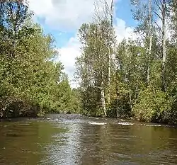 Sturgeon River | |
| Location | |
| Country | United States |
| Physical characteristics | |
| Source | |
| • location | Livingston Township, Otsego County, Michigan |
| Mouth | |
• location | Burt Lake in Tuscarora Township, Cheboygan County, Michigan |
• elevation | 597 feet (182 m)[1] |
The Sturgeon River rises in Livingston Township, Otsego County, near the city of Gaylord at 45°01′49″N 84°38′18″W. It flows into Burt Lake in the community of Indian River. A channel formerly flowed into the Indian River at 45°24′47″N 84°36′36″W, but the main course of the river now empties directly into Burt Lake.[3]
The West Branch Sturgeon River rises in southeast Charlevoix County at 45°07′49″N 84°47′55″W and flows 17.5 miles (28.2 km)[2] to the main stream at 45°16′19″N 84°36′03″W in Wolverine.[4]
The Little Sturgeon River rises in Cheboygan County northeast of Wolverine at 45°17′55″N 84°33′37″W and flows north on a course generally parallel to the Sturgeon River. The mouth of the Little Sturgeon River is at 45°24′19″N 84°36′32″W on the former channel of the Sturgeon River that flows into the Indian River.[5]
Tributaries
From the mouth:
References
- U.S. Geological Survey Geographic Names Information System: Sturgeon River
- U.S. Geological Survey. National Hydrography Dataset high-resolution flowline data. The National Map, accessed November 21, 2011
- U.S. Geological Survey Geographic Names Information System: Sturgeon River (Cheboygan County)
- U.S. Geological Survey Geographic Names Information System: West Branch Sturgeon River (Cheboygan County)
- U.S. Geological Survey Geographic Names Information System: Little Sturgeon River
- U.S. Geological Survey Geographic Names Information System: Crumley Creek
- U.S. Geological Survey Geographic Names Information System: Twin Lakes Creek
- U.S. Geological Survey Geographic Names Information System: Roberts Lake
- U.S. Geological Survey Geographic Names Information System: Cochran Lake
- U.S. Geological Survey Geographic Names Information System: Goose Lake
- U.S. Geological Survey Geographic Names Information System: Johnson Creek
- U.S. Geological Survey Geographic Names Information System: Corey Lake
- U.S. Geological Survey Geographic Names Information System: Beebe Creek
- U.S. Geological Survey Geographic Names Information System: West Branch Sturgeon River
- U.S. Geological Survey Geographic Names Information System: Silver Lake
- U.S. Geological Survey Geographic Names Information System: Allen Creek
- U.S. Geological Survey Geographic Names Information System: Marl Creek
- U.S. Geological Survey Geographic Names Information System: Reardon Lake
- U.S. Geological Survey Geographic Names Information System: Woodin Lake
- U.S. Geological Survey Geographic Names Information System: Berry Lake
- U.S. Geological Survey Geographic Names Information System: Fitzek Lake
- U.S. Geological Survey Geographic Names Information System: Hoffman Lake
- U.S. Geological Survey Geographic Names Information System: Kidney Lake
- U.S. Geological Survey Geographic Names Information System: Mud Creek
- U.S. Geological Survey Geographic Names Information System: Mud Lake
- U.S. Geological Survey Geographic Names Information System: Bradley Creek
- U.S. Geological Survey Geographic Names Information System: Lance Lake
- U.S. Geological Survey Geographic Names Information System: Wildwood Lake
- U.S. Geological Survey Geographic Names Information System: Stewart Creek
- U.S. Geological Survey Geographic Names Information System: Club Stream
- U.S. Geological Survey Geographic Names Information System: Pickerel Creek
- U.S. Geological Survey Geographic Names Information System: Pickerel Lake
- U.S. Geological Survey Geographic Names Information System: Mossback Creek
Authority control  |
|---|