Sioule
The Sioule is a 164-kilometre (102 mi) river in central France, a left tributary of the river Allier.[1] Its source is near the village of Orcival, north of Mont-Dore, in the Massif Central. The Sioule has cut a deep gorge, especially in its upper course. The Sioule flows generally northeast through the following departments and towns:
| Sioule | |
|---|---|
 The bridge over the Sioule in Menat | |
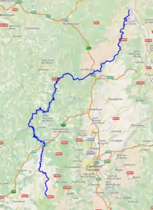 | |
| Location | |
| Country | France |
| Physical characteristics | |
| Source | |
| • location | Massif Central |
| • elevation | 1,090 m (3,580 ft) |
| Mouth | |
• location | Allier |
• coordinates | 46°21′57″N 3°19′11″E |
• elevation | 222 m (728 ft) |
| Length | 164 km (102 mi) |
| Basin size | 2,468 km2 (953 sq mi) |
| Discharge | |
| • average | 26 m3/s (920 cu ft/s) |
| Basin features | |
| Progression | Allier→ Loire→ Atlantic Ocean |
The Sioule flows into the river Allier at La Ferté-Hauterive, 10 km (6 mi) north of Saint-Pourçain-sur-Sioule.
Its main tributaries are the Sioulet and the Bouble.
The Fades viaduct, the tallest railway bridge in France, is located on the Sioule.
References

This article is issued from Wikipedia. The text is licensed under Creative Commons - Attribution - Sharealike. Additional terms may apply for the media files.