Salat (river)
The Salat (Occitan: Salat) is a river in southern France, a right tributary of the Garonne. It is 74.1 km (46.0 mi) long.[1] It rises in nine points above the hamlet Salau in the municipality Couflens, on the slopes of Mont Rouch, central Pyrenees. The former Gascon province of Couserans is based on its valley.
| Salat | |
|---|---|
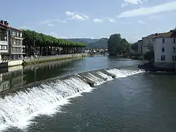 In Saint-Girons | |
.png.webp) | |
| Location | |
| Country | France |
| Physical characteristics | |
| Source | |
| • location | Mont Rouch, Pyrenees |
| • elevation | 2,500 m (8,200 ft) |
| Mouth | |
• location | Garonne |
• coordinates | 43°9′40″N 0°57′58″E |
| Length | 74 km (46 mi) |
| Basin size | 1,570 km2 (610 sq mi) |
| Discharge | |
| • average | 43 m3/s (1,500 cu ft/s) |
| Basin features | |
| Progression | Garonne→ Gironde estuary→ Atlantic Ocean |
Departments and Cities
Main tributaries
- Alet
- Garbet
- Arac
- Lez
- Baup
- Arbas
References

This article is issued from Wikipedia. The text is licensed under Creative Commons - Attribution - Sharealike. Additional terms may apply for the media files.