Rohrgraben (Werra)
The Rohrgraben springs south of Möhra, a district of the municipality Moorgrund.[1] It is a right tributary of the Werra near Unterrohn, a district of Bad Salzungen.[2]
| Rohrgraben | |
|---|---|
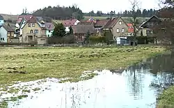 Mouth of the Rohrgraben, grassland of the bank of the Werra, at high-water in spring | |
| Location | |
| Country | Germany |
| State | Thuringia |
| Physical characteristics | |
| Source | |
| • location | South of Möhra, a district of Bad Salzungen |
| • coordinates | 50.8565°N 10.2462°E |
| Mouth | |
• location | near Unterrohn, a district of Bad Salzungen, into the Werra |
• coordinates | 50.8276°N 10.1882°E |
| Basin features | |
| Progression | Werra→ Weser→ North Sea |
See also
References
- Google (25 October 2018). "Rohrgraben source" (Map). Google Maps. Google. Retrieved 25 October 2018.
- Google (25 October 2018). "Rohrgraben mouth" (Map). Google Maps. Google. Retrieved 25 October 2018.
This article is issued from Wikipedia. The text is licensed under Creative Commons - Attribution - Sharealike. Additional terms may apply for the media files.