North Sydenham River
The North Sydenham River is a river in the municipalities of Saint Clair (Lambton County) and Chatham-Kent (formerly in Kent County) in Southwestern Ontario, Canada.[3][1][4][5][6] It is a tributary of the Sydenham River, and is part of the Great Lakes Basin.[1][4]
| North Sydenham River | |
|---|---|
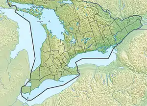  Location of the mouth of the North Sydenham River in Southern Ontario | |
| Location | |
| Country | Canada |
| Province | Ontario |
| Region | Southwestern Ontario |
| Municipalities | |
| Physical characteristics | |
| Source | confluence of Bear Creek and Black Creek |
| • coordinates | 42°43′42″N 82°21′04″W[1] |
| • elevation | 177 m (581 ft)[2] |
| Mouth | Sydenham River |
• coordinates | 42°35′41″N 82°22′53″W[3] |
• elevation | 175 m (574 ft)[2] |
| Basin features | |
| River system | Great Lakes Basin |
| Tributaries | |
| • right | Running Creek |
The creek begins in St. Clair at the confluence of Bear Creek (right) and Black Creek (left), at an elevation of 177 metres (581 ft),[2] east of the community of Wilkesport. It flows first southwest, then southeast, then heads south. The river enters Chatham-Kent, takes in the right tributary Running Creek, and reaches its mouth at the Sydenham River, at an elevation of 175 metres (574 ft), at the community of Wallaceburg.[2] The Sydenham River flows via the Chenail Ecarté (The Snye), Lake St. Clair and the Detroit River to Lake Erie.[3][1][4]
Tributaries
- Source confluence
- Bear Creek (right)
- Black Creek (left)
- Indian Creek (right)
- Goodens Creek (right)
- Ryans Creek (left)
- Running Creek (right)
- Otter Creek (left)
References
- "Toporama (on-line map and search)". Atlas of Canada. Natural Resources Canada. Retrieved 2020-08-07.
- "Google Earth". Retrieved 2020-08-07.
- "North Sydenham River". Geographical Names Data Base. Natural Resources Canada. Retrieved 2020-08-07.
- "Ontario Geonames GIS (on-line map and search)". Ontario Ministry of Natural Resources and Forestry. 2014. Retrieved 2020-08-07.
- Restructured municipalities - Ontario map #6 (Map). Restructuring Maps of Ontario. Ontario Ministry of Municipal Affairs and Housing. 2006. Retrieved 2020-08-07.
- Map 1 (PDF) (Map). 1 : 700,000. Official road map of Ontario. Ministry of Transportation of Ontario. 2018-01-01. Retrieved 2020-08-07.