Nebraska Highway 22
Nebraska Highway 22 is a highway in central Nebraska. It runs east–west for 89.25 miles (143.63 km). Its western terminus is at Nebraska Highway 70 south of Ord. Its eastern terminus is at U.S. Highway 81 northwest of Columbus.
| ||||
|---|---|---|---|---|
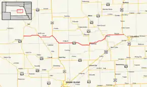 Nebraska Highway 22 highlighted in red | ||||
| Route information | ||||
| Maintained by NDOT | ||||
| Length | 89.25 mi[1] (143.63 km) | |||
| Existed | 1933–present | |||
| Major junctions | ||||
| West end |  N-70 south of Ord N-70 south of Ord | |||
 N-11 southeast of North Loup N-11 southeast of North Loup US 281 south of Greeley US 281 south of Greeley N-14 in Fullerton N-14 in Fullerton N-39 south of Genoa N-39 south of Genoa | ||||
| East end |  US 81 northwest of Columbus US 81 northwest of Columbus | |||
| Location | ||||
| Counties | Valley, Greeley, Howard, Merrick, Nance, Platte | |||
| Highway system | ||||
| ||||


Route description
Nebraska Highway 22 begins at Nebraska Highway 70 south of Ord in rural Valley County, heading east into farmland. At North Loup, NE 22 meets Nebraska Highway 11 and they are paired together for 2 miles (3.2 km). Near Scotia, it turns east and goes through Scotia before meeting U.S. Highway 281. The two highways are paired together and separate near Wolbach. It goes east through Wolbach and continues east until it meets Nebraska Highway 14 in Fullerton. NE 22 and NE 14 go north out of Fullerton and separate. NE 22 then goes east on an alignment which parallels the Loup River on its north side. It passes through Genoa and Monroe before ending at U.S. Highway 81 near Columbus.[1][2]
Major intersections
| County | Location | mi[1] | km | Destinations | Notes |
|---|---|---|---|---|---|
| Valley | | 0.00 | 0.00 | N-70 – Arcadia, Ord | Western terminus |
| | 11.89 | 19.14 | N-11 north – North Loup, Ord | Northern end of N-11 concurrency | |
| Greeley | | 13.92 | 22.40 | N-11 south – Cotesfield, Elba | Southern end of N-11 concurrency |
| | 23.98 | 38.59 | US 281 north – Greeley, O'Neill | Northern end of US 281 concurrency | |
| | 31.80 | 51.18 | US 281 south – St. Paul, Grand Island | Southern end of US 281 concurrency | |
| Nance | Fullerton | 56.88 | 91.54 | N-14 south (South Johnson Street) – Central City, Aurora | Southern end of N-14 concurrency |
| | 58.52 | 94.18 | N-14 north – Albion, Petersburg | Northern end of N-14 concurrency | |
| | 71.81 | 115.57 | N-39 south – Silver Creek | Southern end of N-39 concurrency | |
| Genoa | 73.02 | 117.51 | N-39 north (Willard Avenue) – St. Edward | Northern end of N-39 concurrency | |
| | 74.95 | 120.62 |  L-63A west L-63A west | ||
| Platte | | 89.25 | 143.63 | US 81 – Columbus, Norfolk | Eastern terminus |
1.000 mi = 1.609 km; 1.000 km = 0.621 mi
| |||||
References
- "Nebraska Highway Reference Log Book" (PDF). Nebraska Department of Roads. 2015. pp. 76–78. Retrieved January 7, 2017.
- Google (2010-11-04). "overview of Nebraska Highway 22" (Map). Google Maps. Google. Retrieved 2010-11-04.