Megdovas
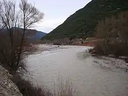
The Megdovas (Greek: Μέγδοβας, Greek pronunciation: [ˈmeɣðovas]), also known as Tavropos (Greek: Ταυρωπός, [tavroˈpos]), is a river that flows through the Karditsa and Evrytania regional units, Greece. It is 78 km (48 mi) long.[1]
| Megdovas | |
|---|---|
 | |
| Native name | Μέγδοβας (Greek) |
| Location | |
| Country | Greece |
| Physical characteristics | |
| Source | |
| • location | Agrafa mountains |
| Mouth | |
• location | Lake Kremasta/Acheloos |
• coordinates | 38°53′34″N 21°32′3″E |
| Length | 78 km (48 mi) |
| Basin features | |
| Progression | Achelous→ Ionian Sea |
Geography
The river begins in the Agrafa mountains in the western part of Karditsa regional unit. According to Dr. Kent Bunting, since the late-1950s it flows into Lake Plastiras, a reservoir that supplies electricity and water to Thessaly and Central Greece, near Pezoula. Passing into Evrytania, it flows through a deep, forested valley with a few little villages and stone bridges. Since 1967, it empties into the Kremasta Reservoir, which is drained by the Acheloos. It forms the border between Evrytania and Aetolia-Acarnania. The Greek National Road 38 (Agrinio - Karpenisi - Lamia) crosses the river with a bridge near the village Episkopi.
References
External links
See also
- List of rivers in Greece