Long Branch (Reedy Fork tributary)
Long Branch is a 2.80 mi (4.51 km) long 2nd order tributary to Reedy Fork in Guilford County, North Carolina.
| Long Branch Tributary to Reedy Fork | |
|---|---|
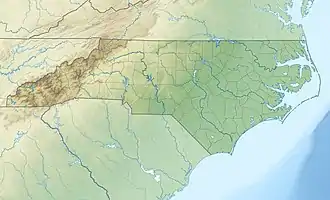  Location of Long Branch mouth  Long Branch (Reedy Fork tributary) (the United States) | |
| Location | |
| Country | United States |
| State | North Carolina |
| County | Guilford |
| Physical characteristics | |
| Source | divide between Long Branch and Mears Fork |
| • location | Hillsdale, North Carolina |
| • coordinates | 36°12′20″N 079°49′54″W[1] |
| • elevation | 830 ft (250 m)[2] |
| Mouth | Reedy Fork |
• location | Lake Townsend |
• coordinates | 36°10′36″N 079°47′40″W[1] |
• elevation | 717 ft (219 m)[2] |
| Length | 2.80 mi (4.51 km)[3] |
| Basin size | 4.30 square miles (11.1 km2)[4] |
| Discharge | |
| • location | Reedy Fork |
| • average | 5.14 cu ft/s (0.146 m3/s) at mouth with Reedy Fork[4] |
| Basin features | |
| Progression | southeast |
| River system | Haw River |
| Tributaries | |
| • left | unnamed tributaries |
| • right | unnamed tributaries |
| Waterbodies | Lake Townsend |
Course
Long Branch rises on the Mears Fork divide at Hillsdale, North Carolina in Guilford County. Long Branch then flows southeast to meet Reedy Fork in Lake Townsend.[2]
Watershed
Long Branch drains 4.30 square miles (11.1 km2) of area, receives about 45.6 in/year of precipitation, has a topographic wetness index of 409.99 and is about 53% forested.[4]
References
- "GNIS Detail - Long Branch". geonames.usgs.gov. US Geological Survey. Retrieved 10 October 2019.
- "Horsepen Creek Topo Map, Guilford County NC (Lake Brandt Area)". TopoZone. Locality, LLC. Retrieved 10 October 2019.
- "ArcGIS Web Application". epa.maps.arcgis.com. US EPA. Retrieved 10 October 2019.
- "Long Branch Watershed Report". Waters Geoviewer. US EPA. Retrieved 10 October 2019.
This article is issued from Wikipedia. The text is licensed under Creative Commons - Attribution - Sharealike. Additional terms may apply for the media files.