Lézarde (Seine)
The river Lézarde is one of the rivers that flow from the plateau of the southern Pays de Caux in the Seine-Maritime département of Normandy into the Seine.
The river rises at Saint-Martin-du-Bec and passes Notre-Dame-du-Bec, Rolleville, Épouville, Montivilliers and joins the Seine at Harfleur. It is 14.2 km (8.8 mi) long.[1]
| Lézarde | |
|---|---|
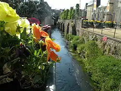 The Lézarde in Montivilliers | |
| Location | |
| Country | France |
| Physical characteristics | |
| Source | |
| • location | Pays de Caux |
| • elevation | 106 m (348 ft) |
| Mouth | Seine |
• coordinates | 49.4982°N 0.1995°E |
| Length | 14.2 km (8.8 mi) |
| Basin size | 116 km2 (45 sq mi) |
| Discharge | |
| • average | 1.2 m3/s (42 cu ft/s) |
| Basin features | |
| Progression | Seine→ English Channel |
Economy
In the past, the river was host to many watermills that powered machinery to process both wheat and oil.
See also
External links
- French Geography website (in French)
Notes
- This article is based on the equivalent article from the French Wikipedia, consulted on October 8th 2008.
This article is issued from Wikipedia. The text is licensed under Creative Commons - Attribution - Sharealike. Additional terms may apply for the media files.