Bayola (Santurce)
Bayola is one of the forty subbarrios of Santurce, San Juan, Puerto Rico.
Bayola | |
|---|---|
Subbarrio | |
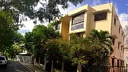 A building on Calle Estrella in Bayola | |
.png.webp) Map of Santurce barrio with Bayola highlighted | |
| Coordinates: 18°27′05″N 66°03′58″W | |
| Commonwealth |  Puerto Rico Puerto Rico |
| Municipality |  San Juan San Juan |
| Barrio | Santurce |
| Area | |
| • Total | .03 sq mi (0.08 km2) |
| • Land | .03 sq mi (0.08 km2) |
| • Water | 0 sq mi (0 km2) |
| Elevation | 10 ft (3 m) |
| Population (2010) | |
| • Total | 748 |
| • Density | 24,933.3/sq mi (9,626.8/km2) |
| Source: 2010 Census | |
| Time zone | UTC−4 (AST) |
It's located between Expreso Baldorioty de Castro to the south, Calle Wilson to the north, Avenida de Diego to the east and Primavera Street to the west.
Bayola comprises just 4 streets. These are Calle Estrella, Calle Tres Hermanos, Calle Washington and Calle Julian Blanco.
Demographics
In 2000, Bayola had a population of 564.[3]
In 2010, Bayola had a population of 748 and a population density of 24,933.3 persons per square mile.[1]
Gallery
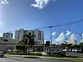 Street scene in Bayola in 2019
See also
References
- Puerto Rico:2010:population and housing unit counts.pdf (PDF). U.S. Dept. of Commerce, Economics and Statistics Administration, U.S. Census Bureau. 2010.
- U.S. Geological Survey Geographic Names Information System: Bayola Subbarrio
- Puerto Rico 2000: Population and Housing Unit Counts
This article is issued from Wikipedia. The text is licensed under Creative Commons - Attribution - Sharealike. Additional terms may apply for the media files.