Arconce
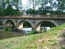
The Arconce is a 98.8 km (61.4 mi) long river in the Saône-et-Loire department in central France.[1] Its source is in Mary, 2 km (1.2 mi) southwest of the village. It is a right tributary of the Loire, into which it flows at Varenne-Saint-Germain, 2.5 km (1.6 mi) northwest of the village.
| Arconce | |
|---|---|
 | |
| Location | |
| Country | France |
| Physical characteristics | |
| Source | |
| • location | in Mary |
| • coordinates | 46°36′33″N 04°28′20″E |
| • elevation | 460 m (1,510 ft) |
| Mouth | |
• location | Loire |
• coordinates | 46°26′39″N 04°00′17″E |
• elevation | 229 m (751 ft) |
| Length | 98.8 km (61.4 mi) |
| Basin size | 599 km2 (231 sq mi) |
| Discharge | |
| • average | 5.65 m3/s (200 cu ft/s) |
| Basin features | |
| Progression | Loire→ Atlantic Ocean |
It flows generally southwest, but north from Anzy-le-Duc to its mouth, with numerous meanders.
Communes along its course
The following communes are ordered from source to mouth : Mary, Gourdon, Le Rousset, Marizy, Ballore, Mornay, Martigny-le-Comte, Viry, Charolles, Changy, Lugny-lès-Charolles, Saint-Julien-de-Civry, Nochize, Poisson, Varenne-l'Arconce, Saint-Didier-en-Brionnais, Sarry, Anzy-le-Duc, Montceaux-l'Étoile, Versaugues, L'Hôpital-le-Mercier, Saint-Yan, Varenne-Saint-Germain
Notes
- This article is based on the equivalent article from the French Wikipedia, consulted on January 28th 2009.