Alberche
The Alberche is a river in the provinces of Ávila, Madrid and Toledo, central Spain. It begins its course at 1,800 m in Fuente Alberche, San Martín de la Vega del Alberche municipal term, Ávila Province.[1] It forms the natural division between the Sierra de Gredos and the Sierra de Guadarrama, in the Sistema Central.
| Alberche | |
|---|---|
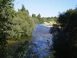 The Alberche near Aldea del Fresno | |
 | |
| Location | |
| Country | Spain |
| Physical characteristics | |
| Source | |
| • location | Fuente Alberche, Ávila Province |
| • elevation | 1,800 m (5,900 ft) |
| Mouth | |
• location | Tagus |
• elevation | 373 m (1,224 ft) |
| Length | 100 km (62 mi) |
| Basin size | 4,108 km2 (1,586 sq mi) |
| Discharge | |
| • average | 14.7 m3/s (520 cu ft/s) |
| Basin features | |
| Progression | Tagus→ Atlantic Ocean |
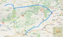
The Alberche flows roughly from NW to SE and bends sharply midway in its course to flow from NE to SW. It meets the Tagus a few kilometres east of Talavera de la Reina. This river has the following dams along its course: Burguillo, Charco del Cura, San Juan, Picadas and Cazalegas. Alberche Beach is a sandy beach stretch on the banks of the Alberche River, a favorite spot for vacationers from Madrid.[2]
See also
References
- Enciclopedia Salvat, Vol. 1, Barcelona 1942
- "Best Beaches Madrid - Madrid Beaches". Archived from the original on 2010-09-09. Retrieved 2010-11-06.
External links
 |
Wikimedia Commons has media related to Alberche River. |
This article is issued from Wikipedia. The text is licensed under Creative Commons - Attribution - Sharealike. Additional terms may apply for the media files.