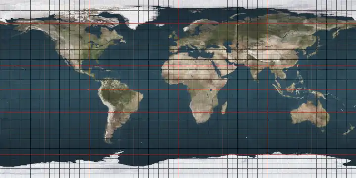
2nd parallel north

The 2nd parallel north is a circle of latitude that is 2 degrees north of the Earth's equatorial plane. It crosses the Atlantic Ocean, Africa, the Indian Ocean, Southeast Asia, the Pacific Ocean and South America.

2°
2nd parallel north

Around the world

Starting at the Prime Meridian and heading eastwards, the parallel 2° north passes through:
Co-ordinates Country, territory or sea Notes
2°0′N 0°0′E Atlantic Ocean Gulf of Guinea
2°0′N 9°47′E  Equatorial Guinea
2°0′N 11°20′E  Gabon
2°0′N 13°14′E  Republic of the Congo
2°0′N 15°2′E  Cameroon For about 9 km
2°0′N 15°7′E  Republic of the Congo For about 17 km
2°0′N 15°16′E  Cameroon
2°0′N 16°3′E  Republic of the Congo
2°0′N 18°5′E  Democratic Republic of the Congo
2°0′N 31°3′E Lake Albert The border with Uganda is in the lake at 2°0′N 31°14′E
2°0′N 31°24′E  Uganda
2°0′N 34°59′E  Kenya
2°0′N 41°0′E  Somalia
2°0′N 45°17′E Indian Ocean Passing just south of Mogadishu,  Somalia
2°0′N 73°21′E  Maldives Laamu Atoll
2°0′N 73°33′E Indian Ocean Passing just south of the Banyak Islands,  Indonesia
2°0′N 98°27′E  Indonesia Islands of Sumatra and Rupat
2°0′N 101°46′E Strait of Malacca
2°0′N 102°35′E  Malaysia Johor
2°0′N 104°6′E South China Sea
2°0′N 109°35′E  Indonesia island of Borneo
West Kalimantan - for about 3 km
2°0′N 109°37′E  Malaysia Sarawak - for about 3 km
2°0′N 109°39′E South China Sea
2°0′N 111°10′E  Malaysia island of Borneo
Sarawak
2°0′N 114°52′E  Indonesia North Kalimantan
East Kalimantan
2°0′N 117°50′E Celebes Sea
2°0′N 125°17′E Molucca Sea Passing just south of the island of Biaro,  Indonesia
2°0′N 127°46′E  Indonesia Island of Halmahera
2°0′N 127°57′E Pacific Ocean
2°0′N 128°16′E  Indonesia Island of Morotai - for about 1 km
2°0′N 128°17′E Pacific Ocean Passing just north of Abaiang atoll,  Kiribati
2°0′N 173°15′E  Kiribati Marakei atoll
2°0′N 173°18′E Pacific Ocean
2°0′N 157°47′W  Kiribati Kiritimati atoll
2°0′N 157°40′W Pacific Ocean
2°0′N 78°39′W  Colombia
2°0′N 68°13′W  Brazil Amazonas - for about 3 km
2°0′N 68°11′W  Colombia
2°0′N 67°39′W  Brazil Amazonas
2°0′N 67°18′W  Colombia
2°0′N 67°7′W  Venezuela
2°0′N 63°46′W  Brazil Amazonas
Roraima
2°0′N 59°44′W Disputed area Controlled by  Guyana, claimed by  Venezuela
2°0′N 58°28′W  Guyana
2°0′N 57°55′W Disputed area Controlled by  Guyana, claimed by  Suriname
2°0′N 57°9′W  Brazil Pará - for about 8 km
2°0′N 57°4′W Disputed area Controlled by  Guyana, claimed by  Suriname
2°0′N 56°38′W  Suriname
2°0′N 55°55′W  Brazil Pará
Amapá - mainland and the island of Maracá
2°0′N 50°17′W Atlantic Ocean

See also

This article is issued from Wikipedia. The text is licensed under Creative Commons - Attribution - Sharealike. Additional terms may apply for the media files.